
Montana: Glacier National Park & West Glacier
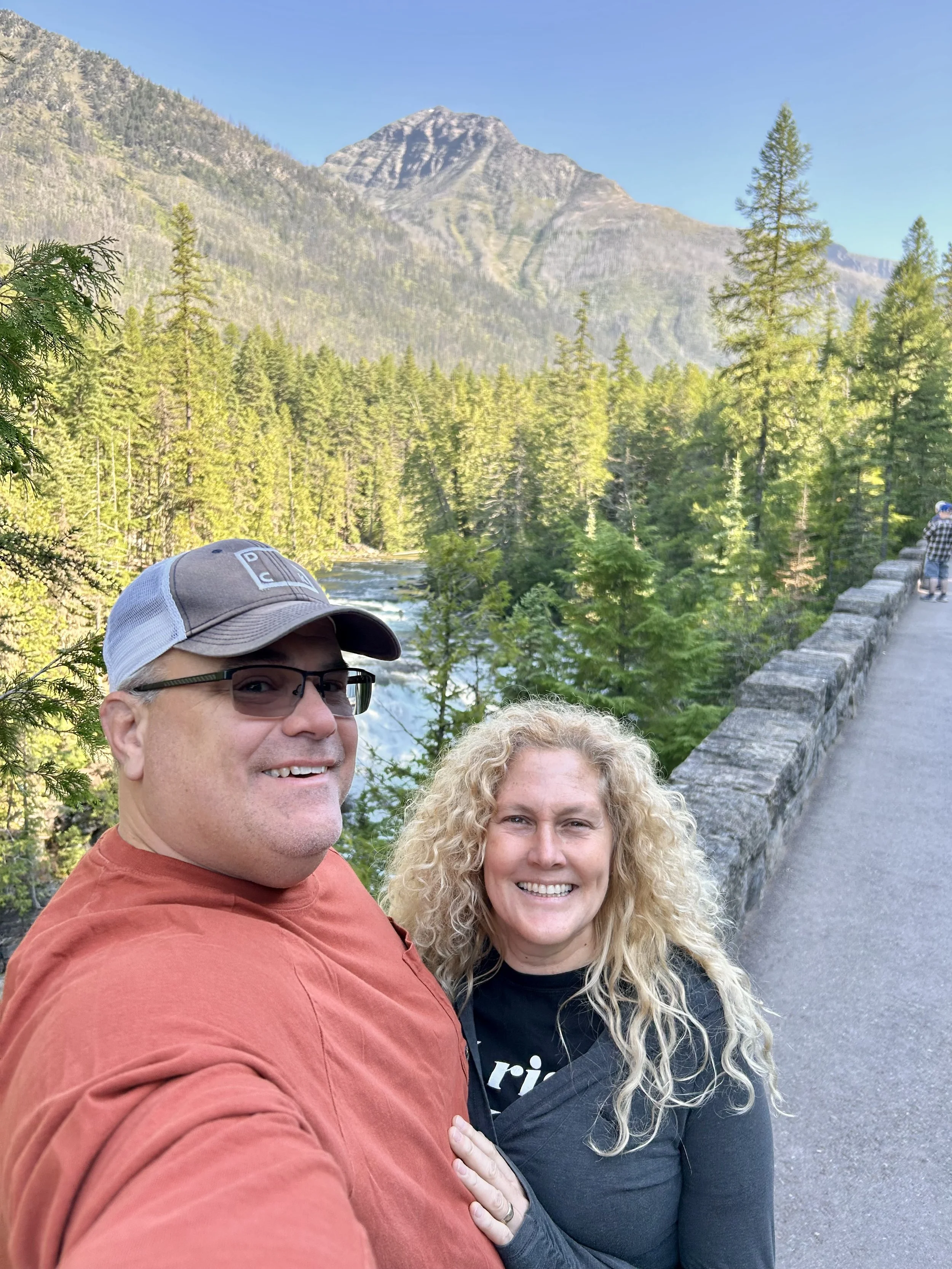
Disclaimer: longest blog yet and it’s the shortest stop. Glacier National is an truly amazing park!
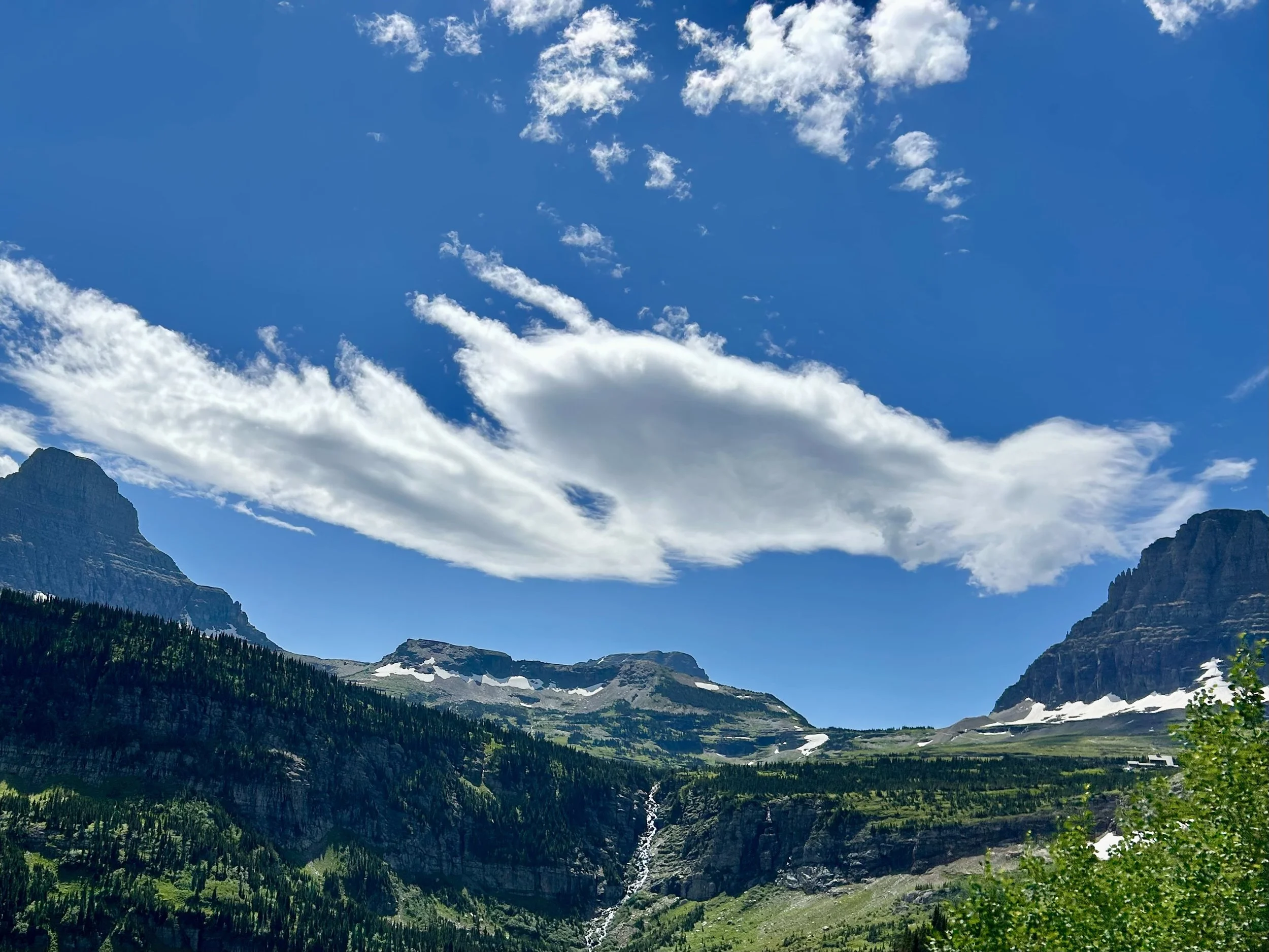
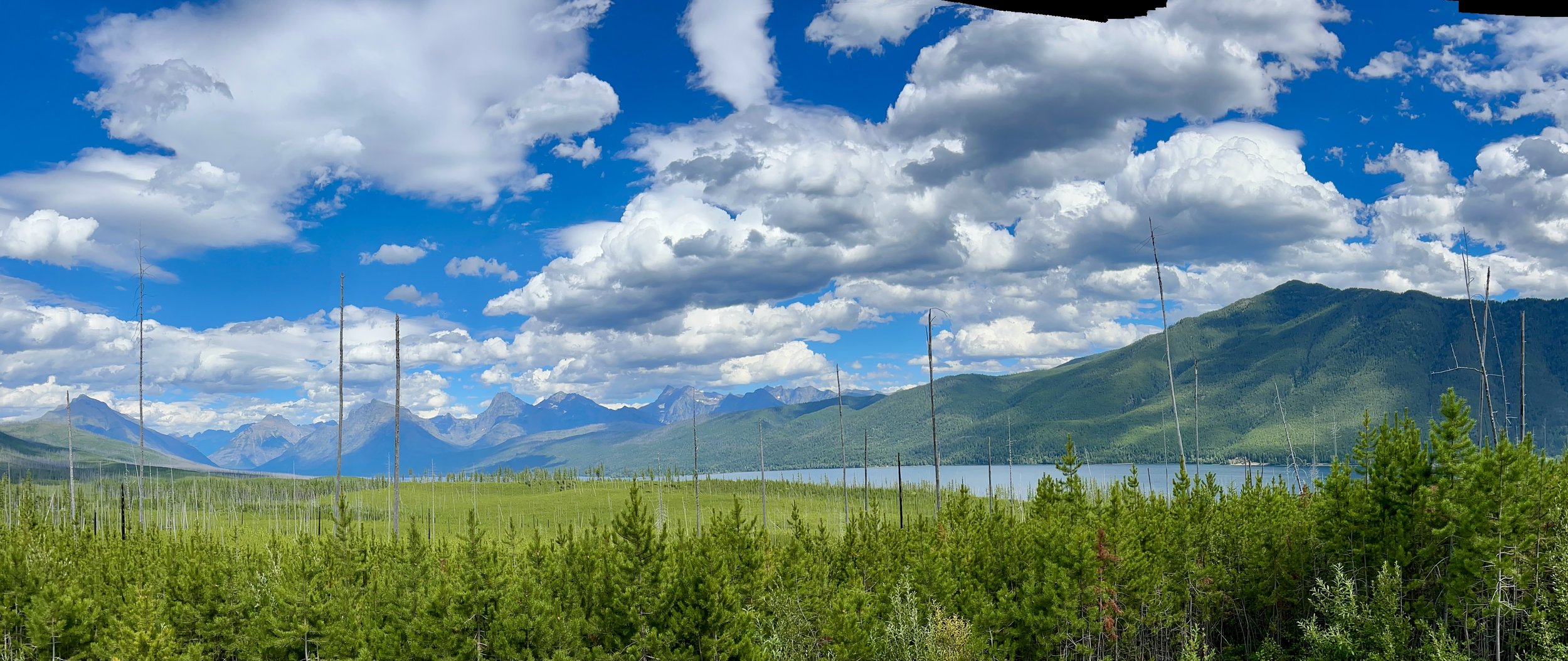
Due to RV repairs we had to make last minute reservations during peak season for some of the busiest National Parks in the country. We were fortunate with a 40ft rig to get 3 nights for our stay at Glacier National so we took it and made the best of our 2 days in the park. Vince literally kept laughing every 10 minutes because we were stopping for yet another screen saver quality view after view after view. Glacier is also unique from other parks because it’s largely driving vs hiking. There are plenty of hikes but it’s drive in/up to get to them and most of the hikes are relatively short compared to most other parks, excluding the “get lost for a week hikes” to the north side of the park. There are only two main roads through the park and along the western boundary and they are controlled by timed entry passes to help with crowding, which is new this year. It’s one lane each direction so a traffic jam really gets to be a problem and a good portion of the Driving to the Sun Road (the east-west road) is a 500-1000ft drop over the edge so you’re not going anywhere fast. Lots of turn outs for pictures and we probably hit 80% of them. Going to the Sun is roughly a 48mile drive up through the mountains and around the southern lakes of Lake McDonald (west side) and Saint Mary Lake (east side), which are separated by Logan Pass. Logan is only at an elevation of 6,644ft but it is the Continental Divide, so you see rivers flowing down each side of the mountain filling the two lakes… which are uniquely different lakes (see pictures for differences). We had a good but short hike along St Mary’s Lake and did a few side trials to take in the Falls and The Point which offer some stunning views of the turquoise colored water. On our way back we also were treated to some animal sightings, checkout the pics below! Day 1 ended with a 2nd run back up Going to the Sun for some stargazing from the Haystack Creek Overlook, which was amazing and gave Vince and the boys their first view of the Milky-Way 🤯
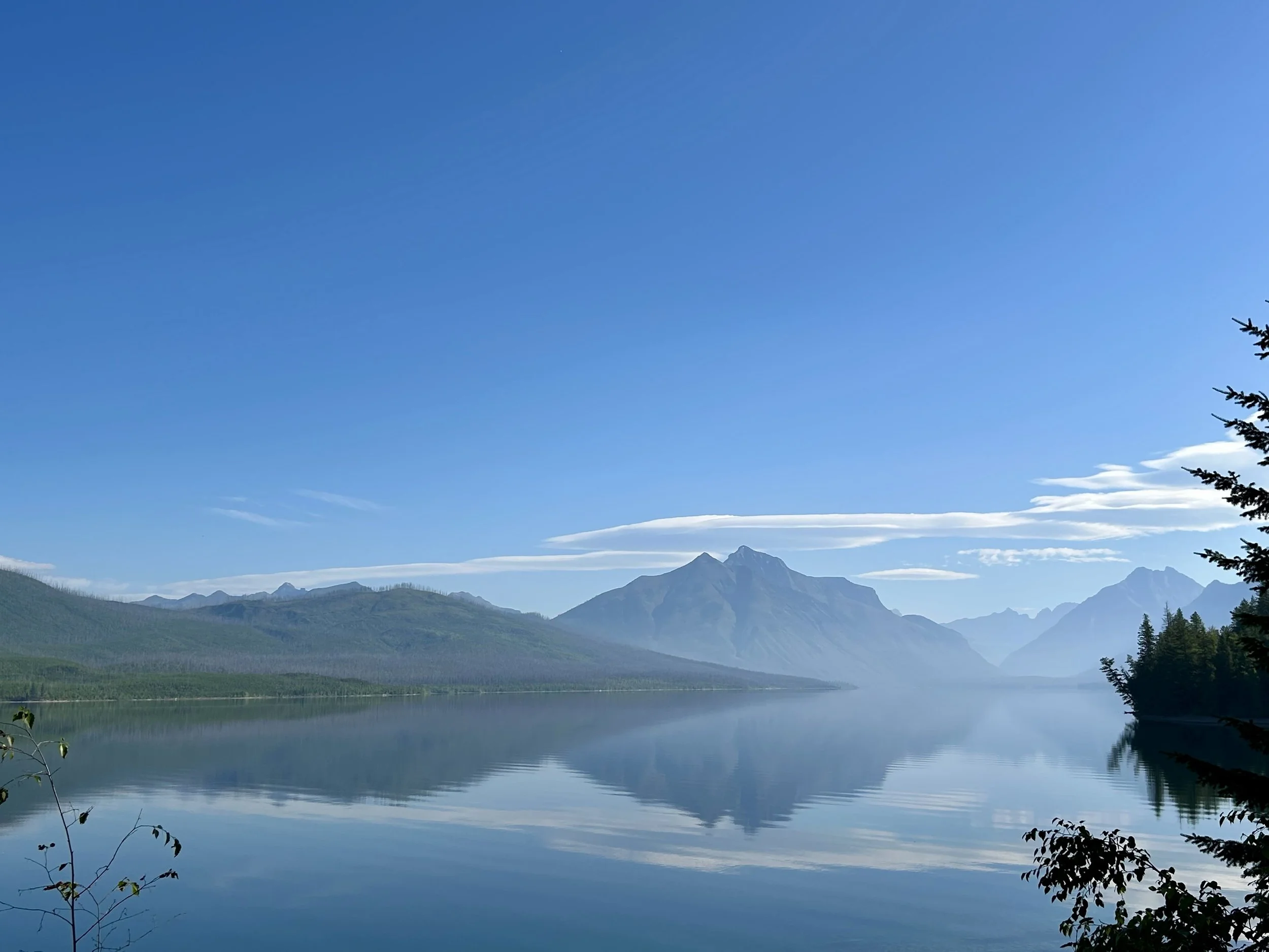
Morning view of the Camas Ridge on the west side of Glacier National from Lake McDonald.
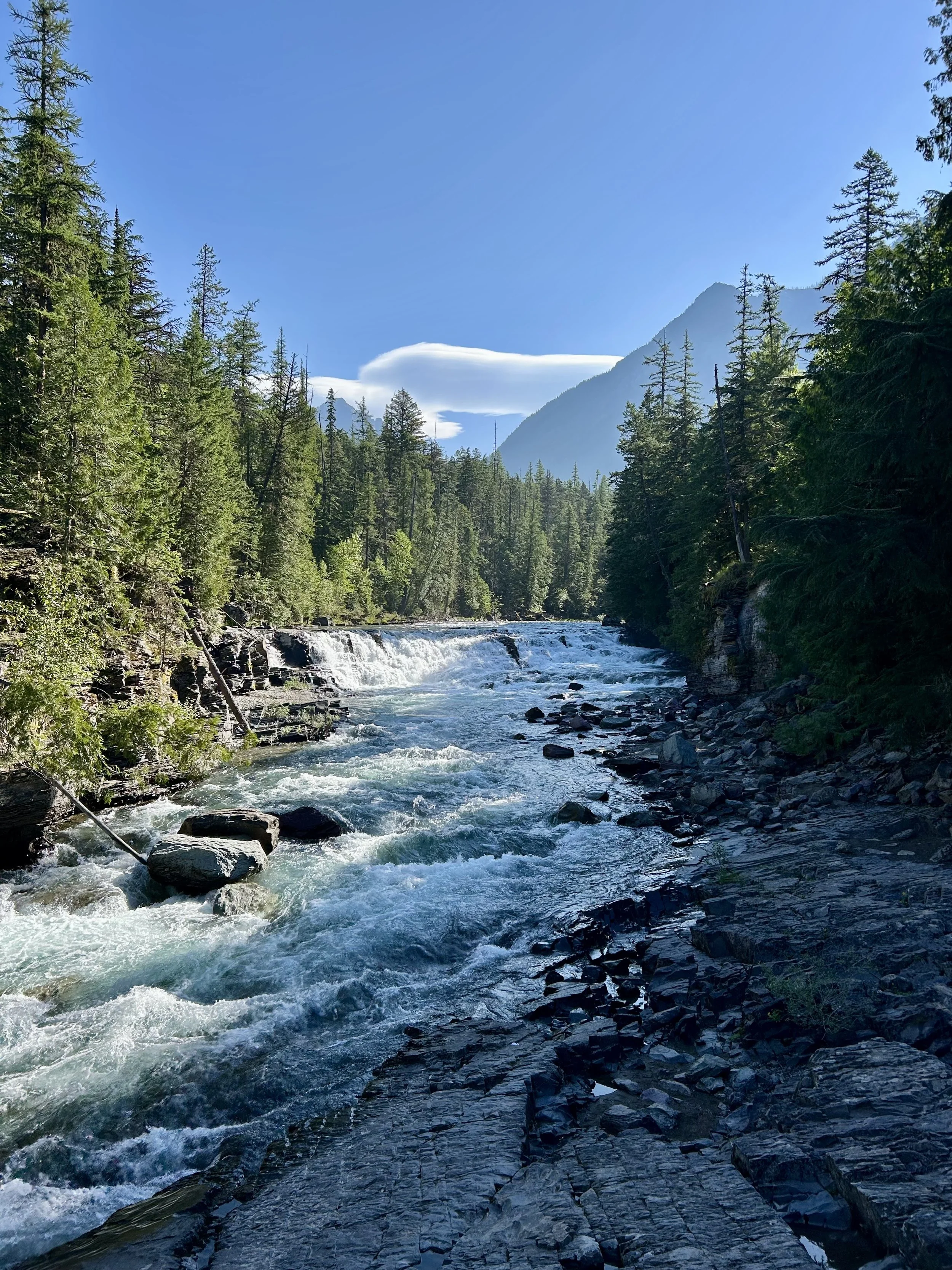
East side of McDonald Falls

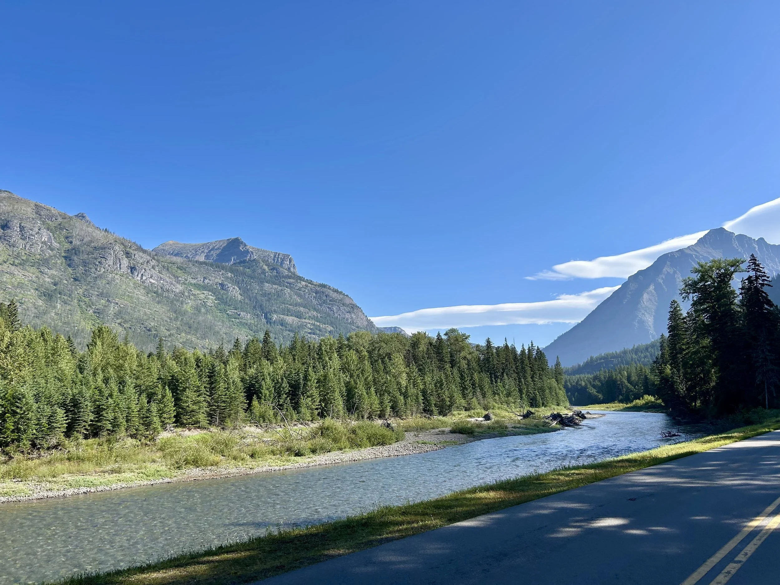
McDonald Creek heading into the mountains on Going to the Sun Road.

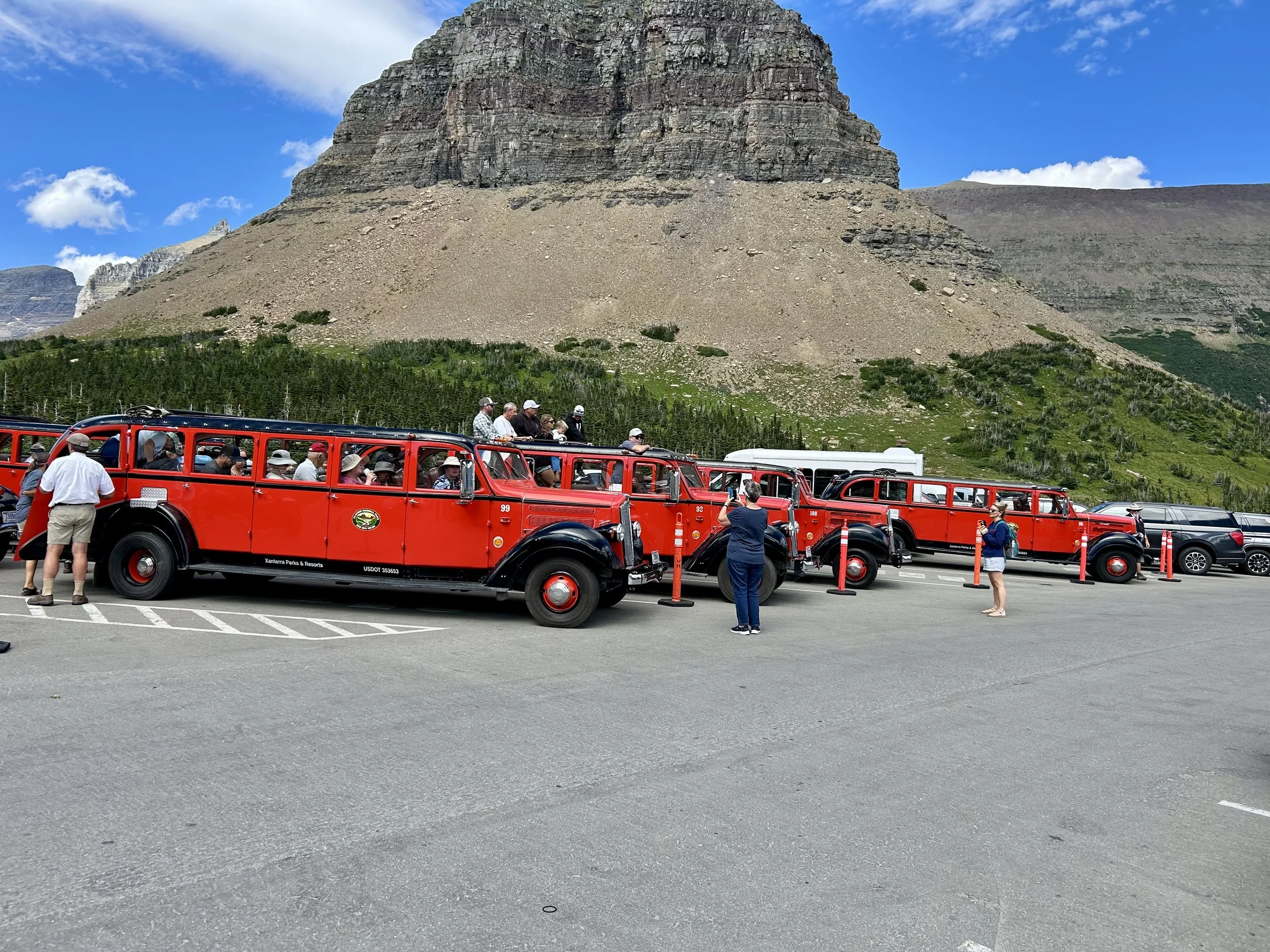
Still McDonald Creek further into the Going to the Sun Road but with the iconic Glacier Red Bus in front leading the way. Crazy how many of these were throughout the park. Seemed like a good way to see the sights but we are cheap so we stuck with our Jeep.

As the Going to the Sun curved up the mountain side we experienced more and more rock walls to navigate. While 2 vehicles could fit side by side, in some areas it was very tight.
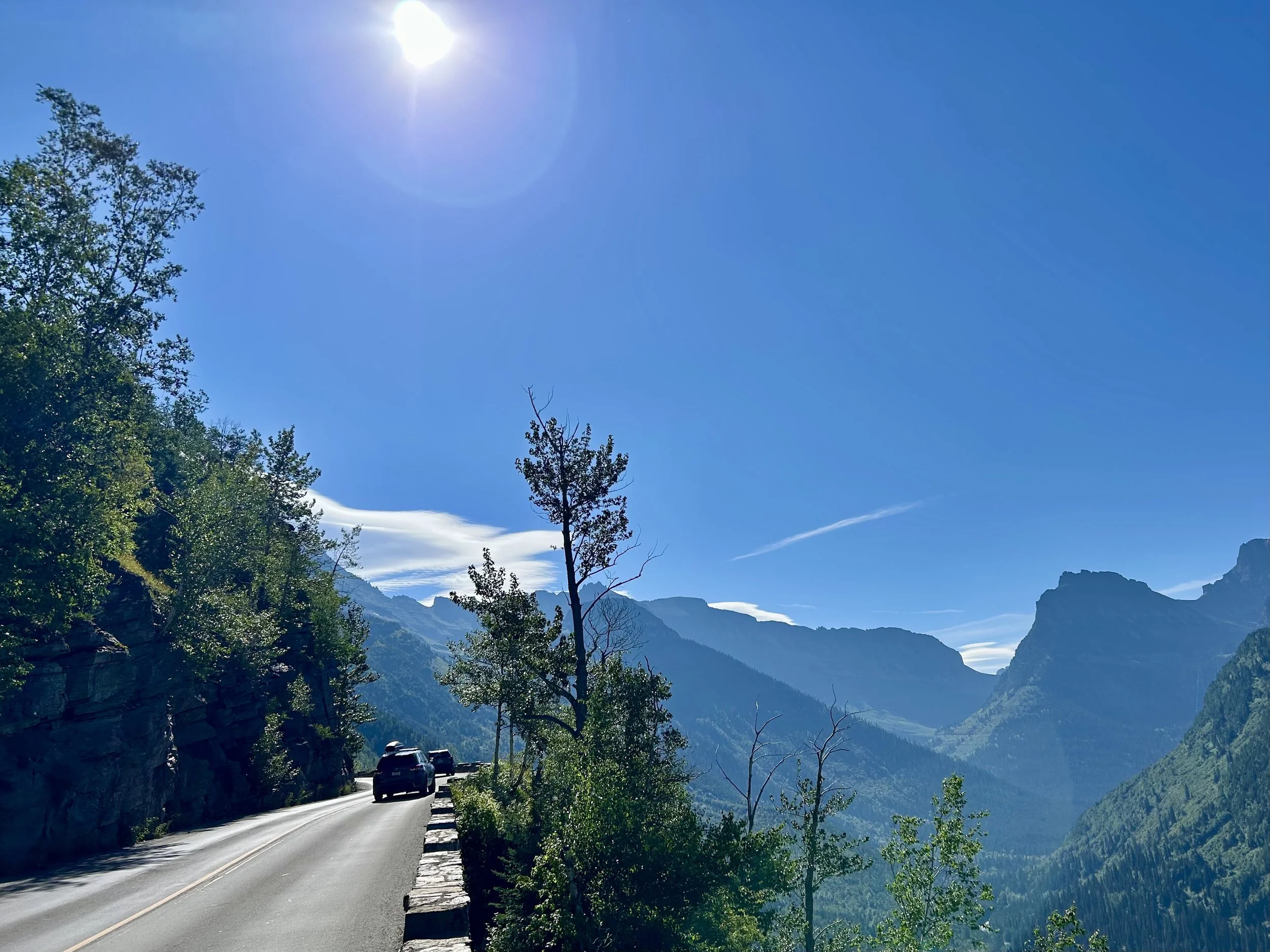
The view from Going to the Sun near Haystack Creek was tremendously distracting. :o)

More distracting views.


Even in July there is still some melt coming down the mountain from the glaciers. The result is some pretty cascades, some named and others just wet but this one is called Alder Creek.


While pano pictures often distort the view a bit, this one was fun showing both valleys from just past Haystack.

This was a very popular bathroom stop just past the Weeping Wall. There was still some snow along the turn out and some formed cool shapes from prior water flow.
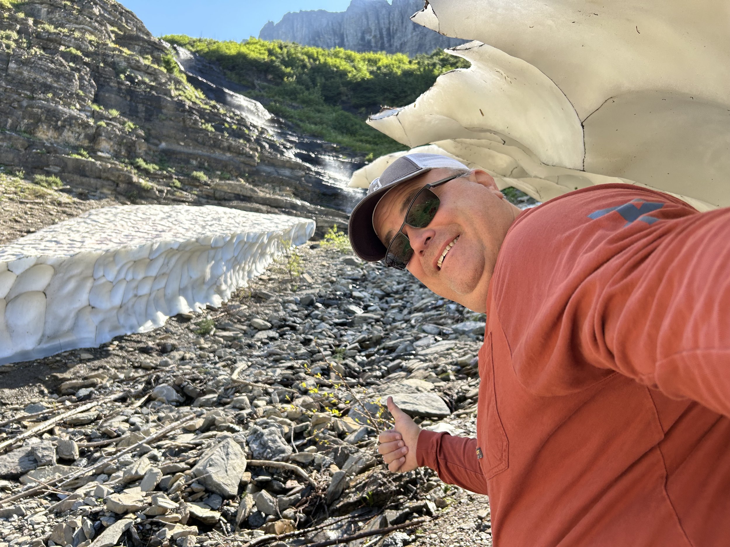
Some of the ice cliff shapes were large enough for Vince to catch some shade.


Tunnel view coming

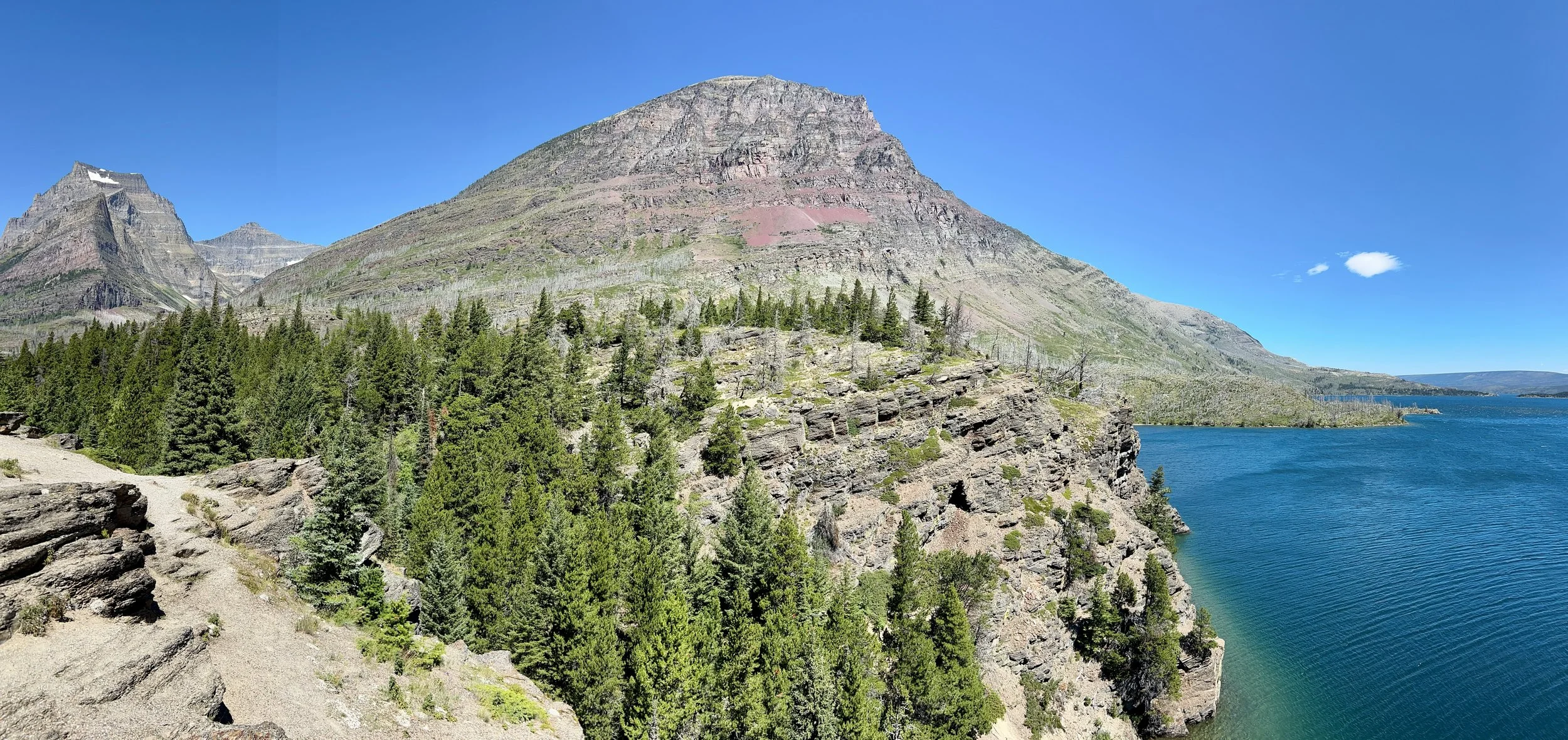
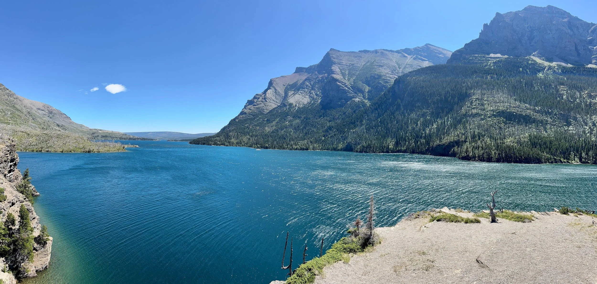
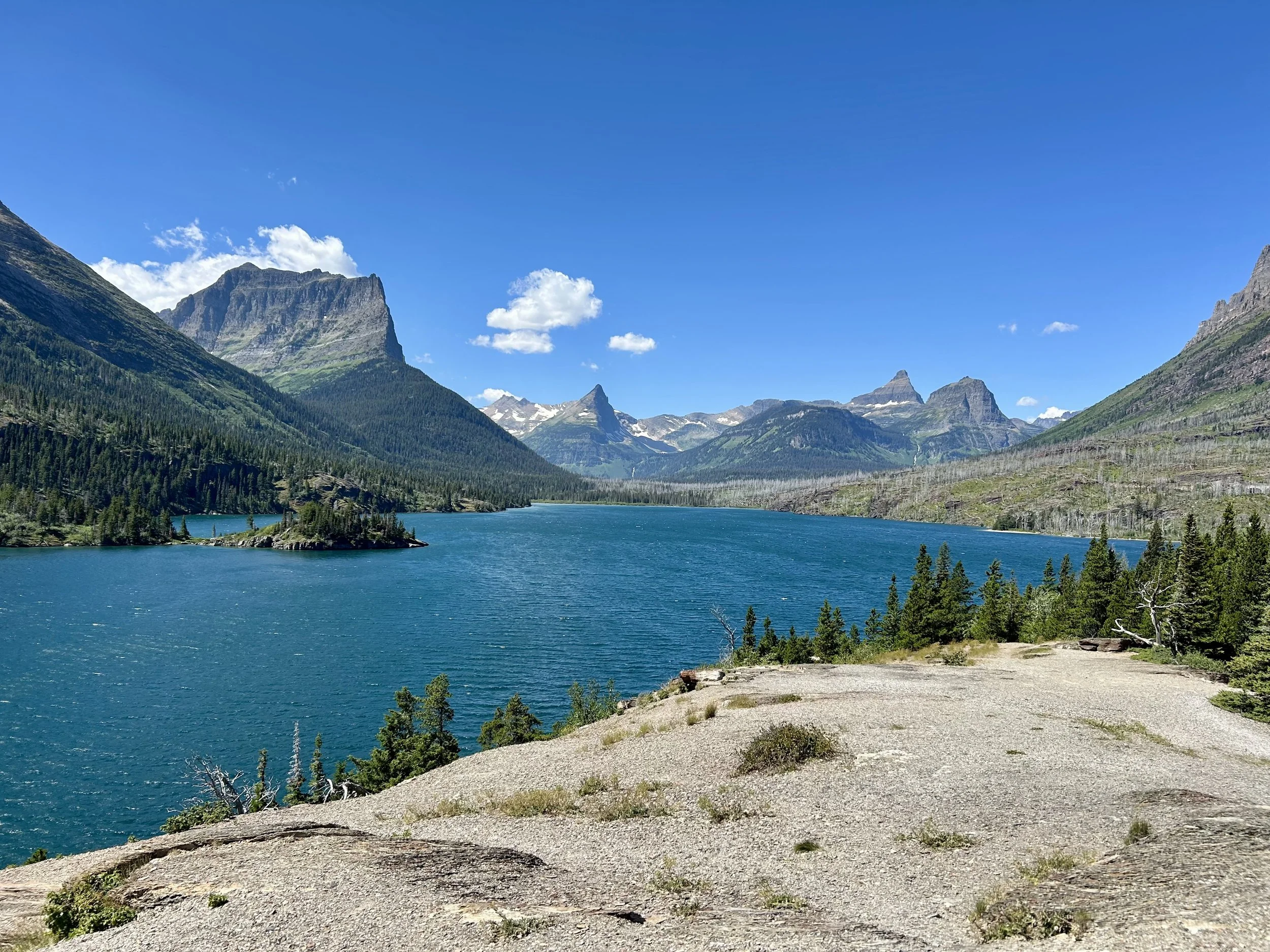
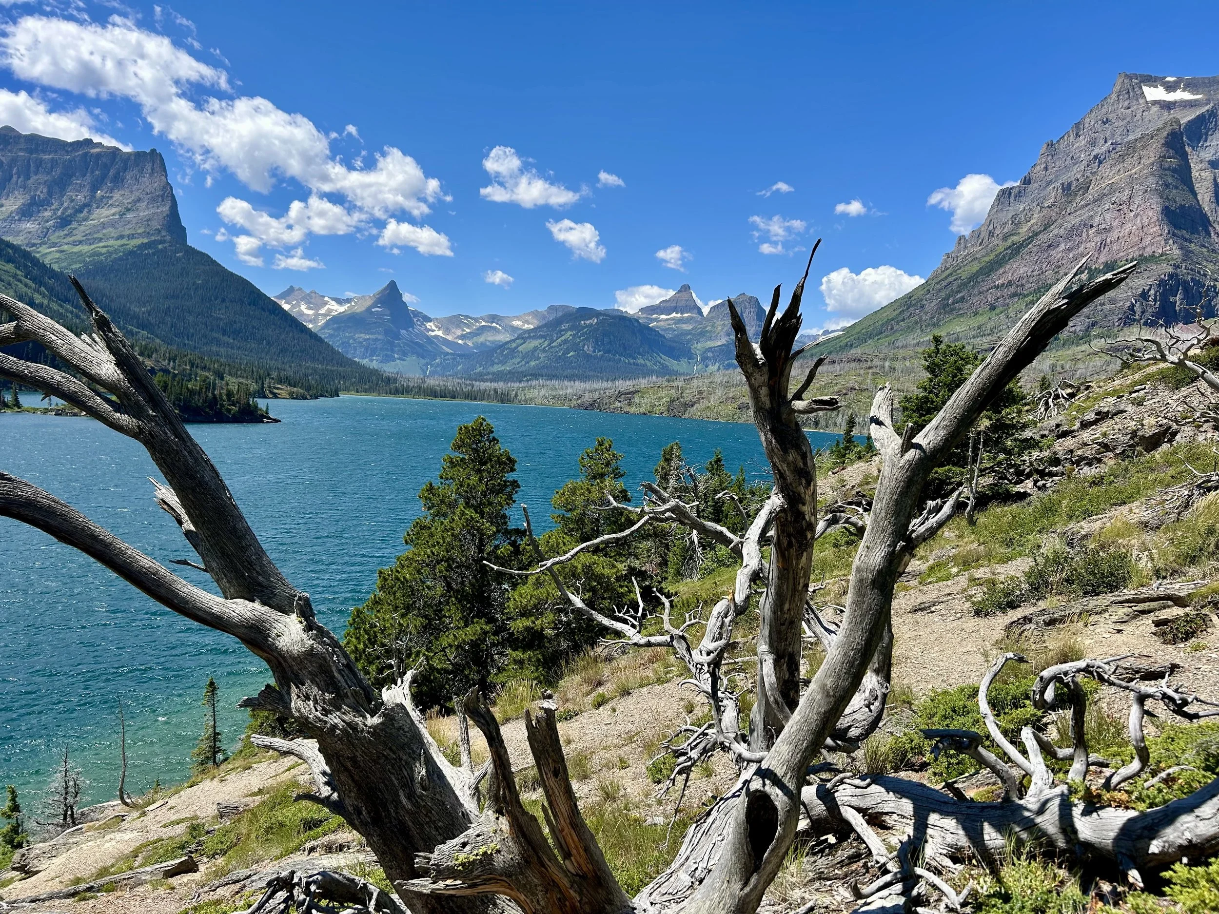
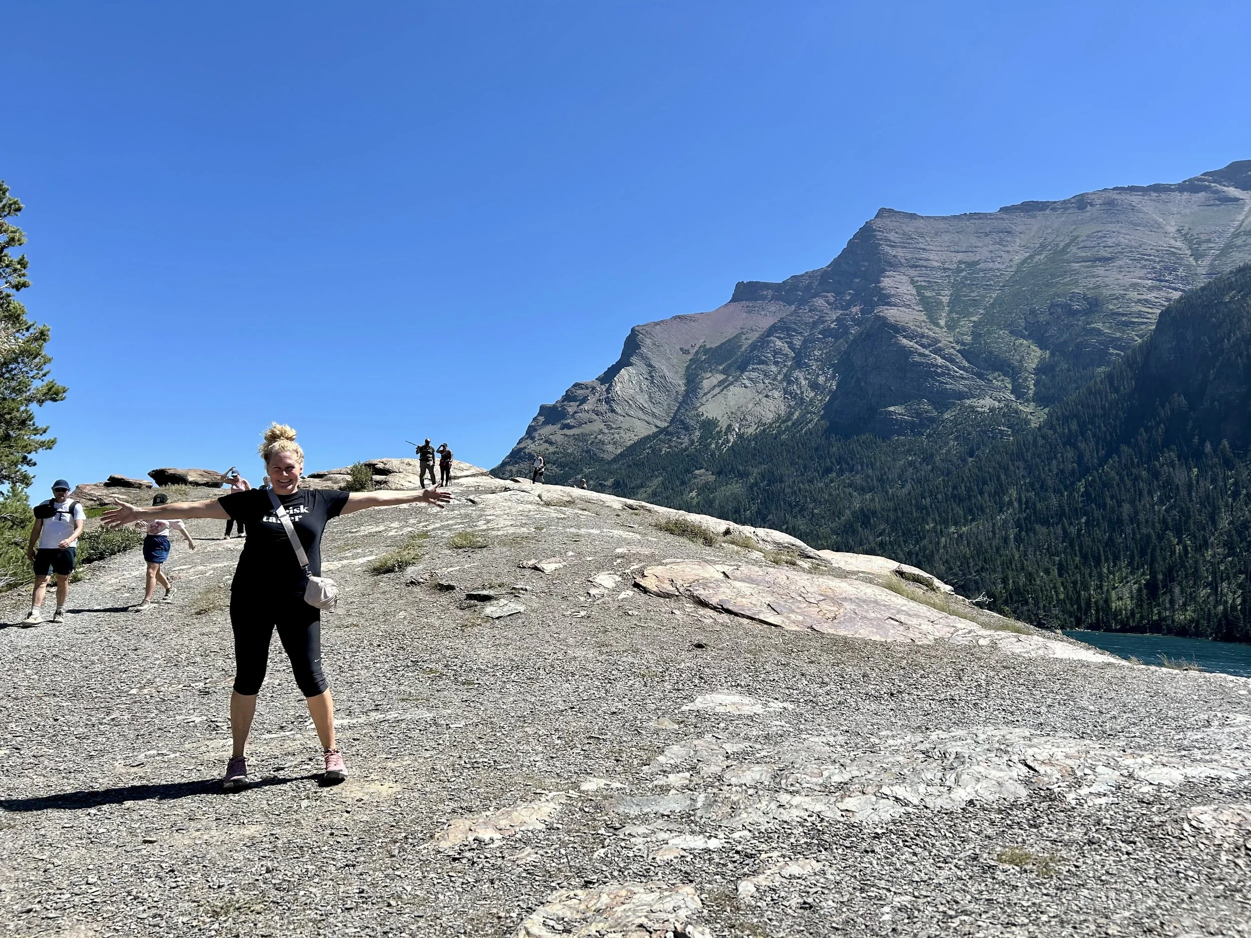
Short hike to St. Mary’s Falls on Sun Point. Saint Mary’s Lake is a beautiful turquoise color from a distance and changes to an almost rainbow color as you approach the shallow sides. Gorgeous but windy on the east side of the park.


This is Sun Point in the middle of Saint Mary Lake. You can do a 360 view but our camera doesn’t quite do that so tried 4 shots, one in each direction.


Vince on the 100+ft rock cliff on the east side of Sun Point.

East side climb down through the trees is a tiny cove under the Sun Point cliffs. Beautiful spot!

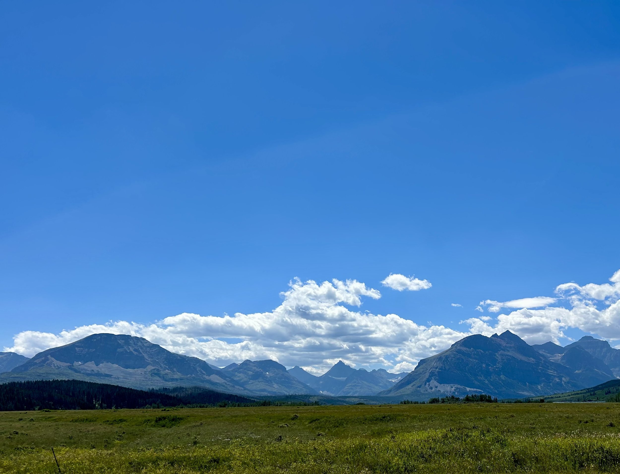
Saint Mary’s Entrance is a long flat grassy plain heading into the mountains. We turned back after a brief visit to the St. Mary Ranger Station

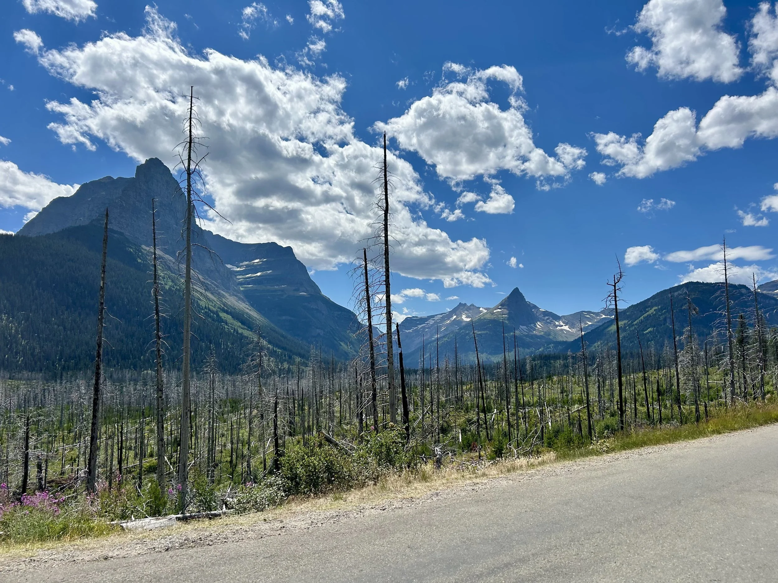
The view changes a bit facing west and we became more aware of how much more barren the landscape was on the east side of the mountains, especially in the areas that experienced a forest fire about 2015. Interesting to see the old trees stripped bare with 10 years of regrow below. Still much drier on this side of the mountain so the growth is different and presumably slower.

When you’re driving and you see a mass parked along the turnouts pointing to the ridge line… you stop and point with them… and of course break out a zoom lens or binoculars.

This was a true safe distance view of two very large grizzlies on the mountainside above the Going to the Sun Road east of Logan’s Pass.

As we get back higher into the mountains it’s much more green and some of the glaciers are visible.
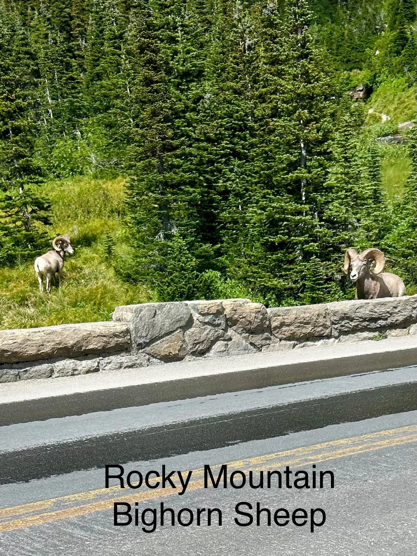
Again lots of cars going slow or parking and here is why. Michele and Peyton jumped out since we couldn’t find parking to take some pictures. This was also not at a safe distance because instead of standing for pictures up the mountain these Big Horned Sheep were coming down to cross the road, where Michele and Peyton were standing.
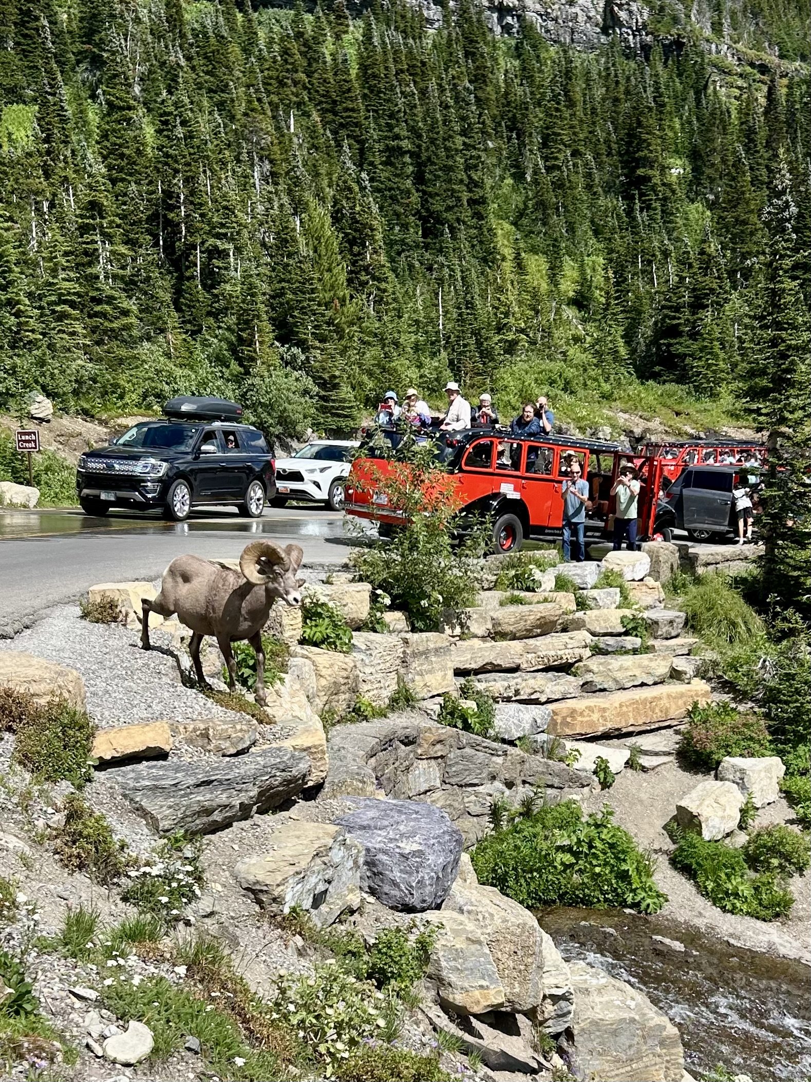
Safely out of the way they got some incredible video and pictures.


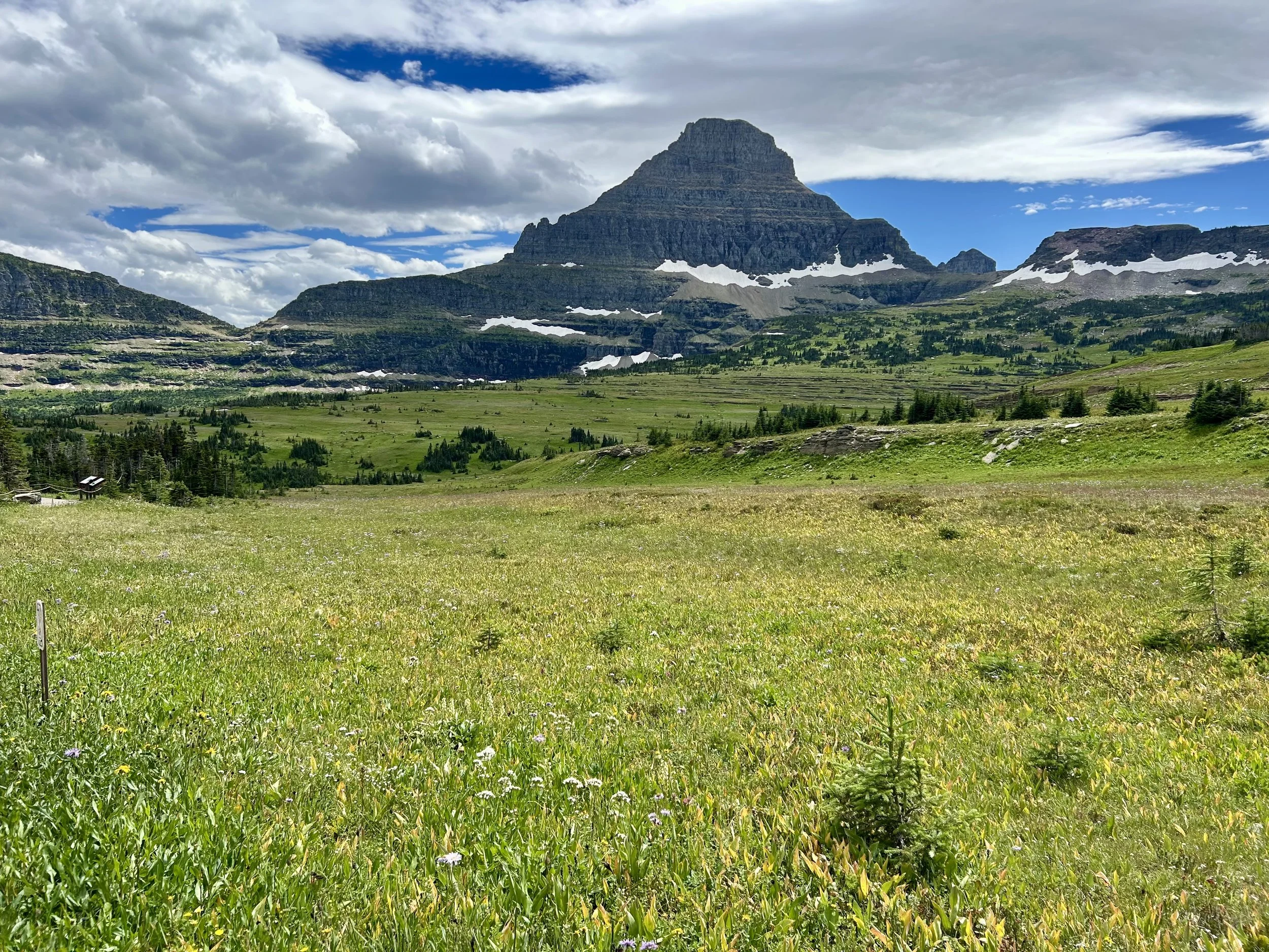
Logan’s Pass is not only the mid-point but also is the Continental Divide. This is the eastern view.

This looks like AI but it’s just a photo friendly Columbian Ground Squirrel at Logan’s Pass. They make chirping sounds that dominates the hillside behind the visitor’s center. Beautiful walk behind the visitor center and worth fighting for parking.
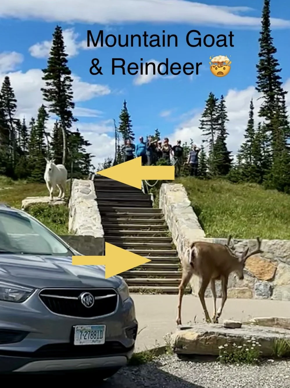
Heading west out of Logan’s Pass we came across a reindeer and a mountain goat on the stairs.

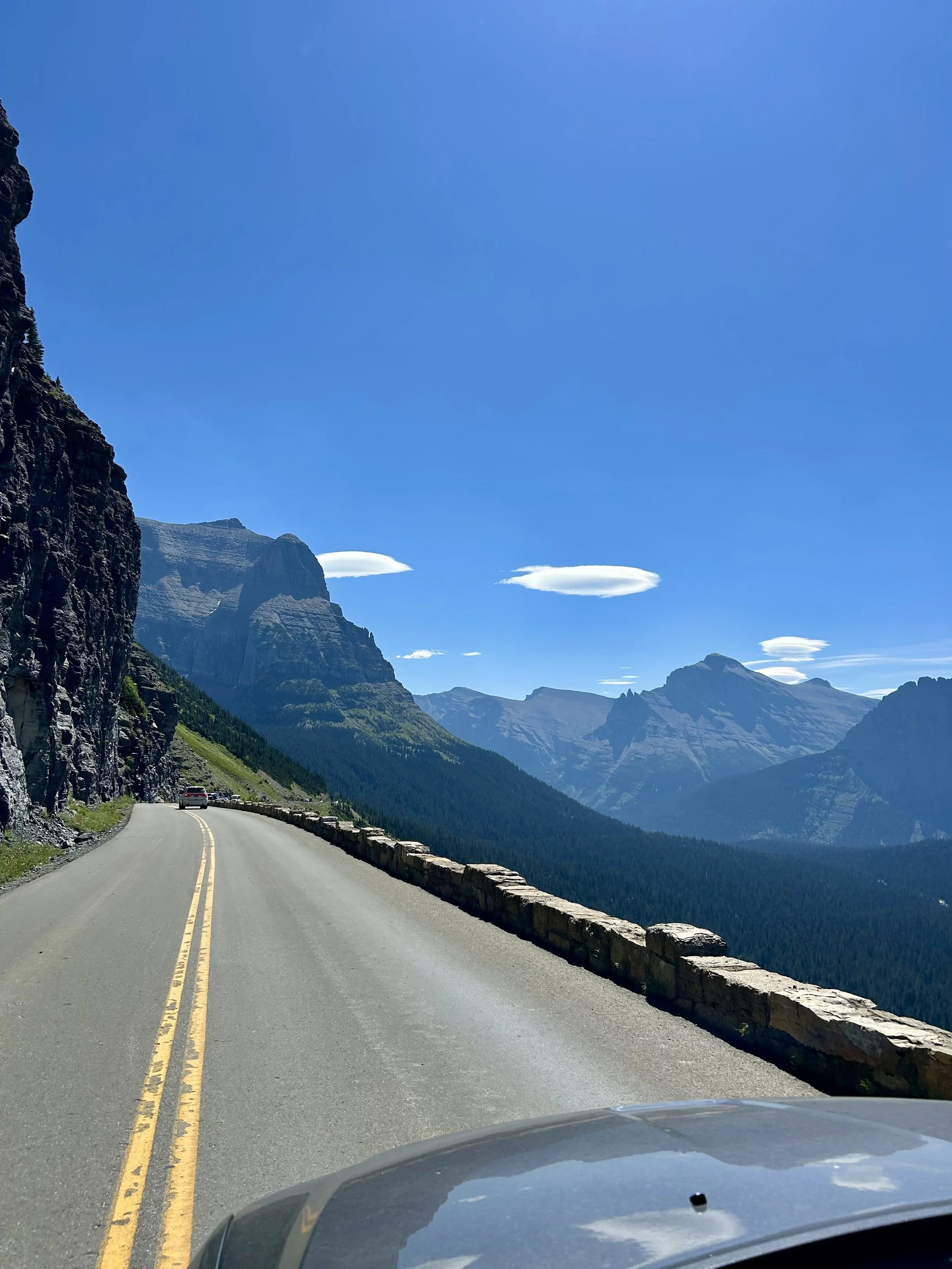
Another view of those tight mountain roads. RV is not recommended even if it is under the 21 ft max limit for the Going to the Sun Road.

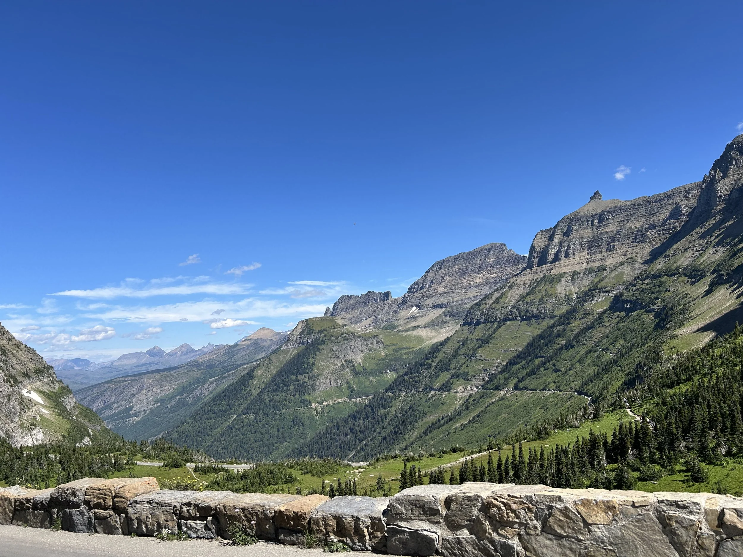
So many breathtaking views… truly is amazing on a sunny day to stop at all the turn-outs.

Robert getting some river-rock throwing time as a reward for the 5.5hr drive through the Going to the Sun. It doesn’t need to take that long but we did a few hikes, stopped for lunch and a lot of turn-outs!

11pm is a great time to enter the park… no lines! Ok there was actually some traffic surprisingly but much less.
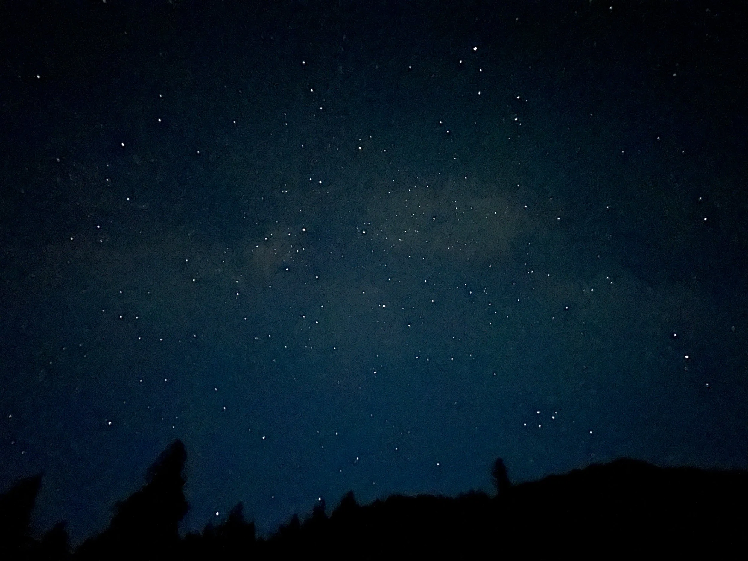
We came into an open spot near Avalanche to check out the stars and could faintly make out the cloudy Milky Way from our first stop and decided to go higher on the Going to the Sun Road to get a clear view.
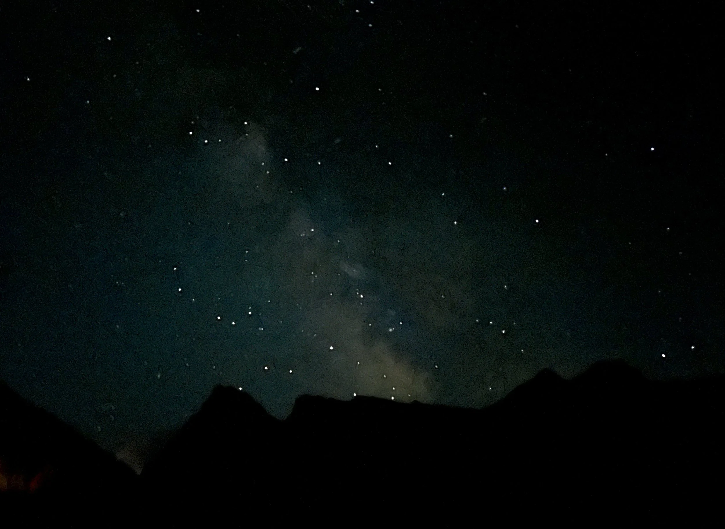
This is a simple iPhone 14 slow aperture shot and it doesn’t do the sky justice but still super cool. The Milky Way was on full display and Vince, Jayden and Robert enjoyed it from the pitch black turnout by Haystack. Cars routinely broke the darkness but we still had an amazing star gazing treat!


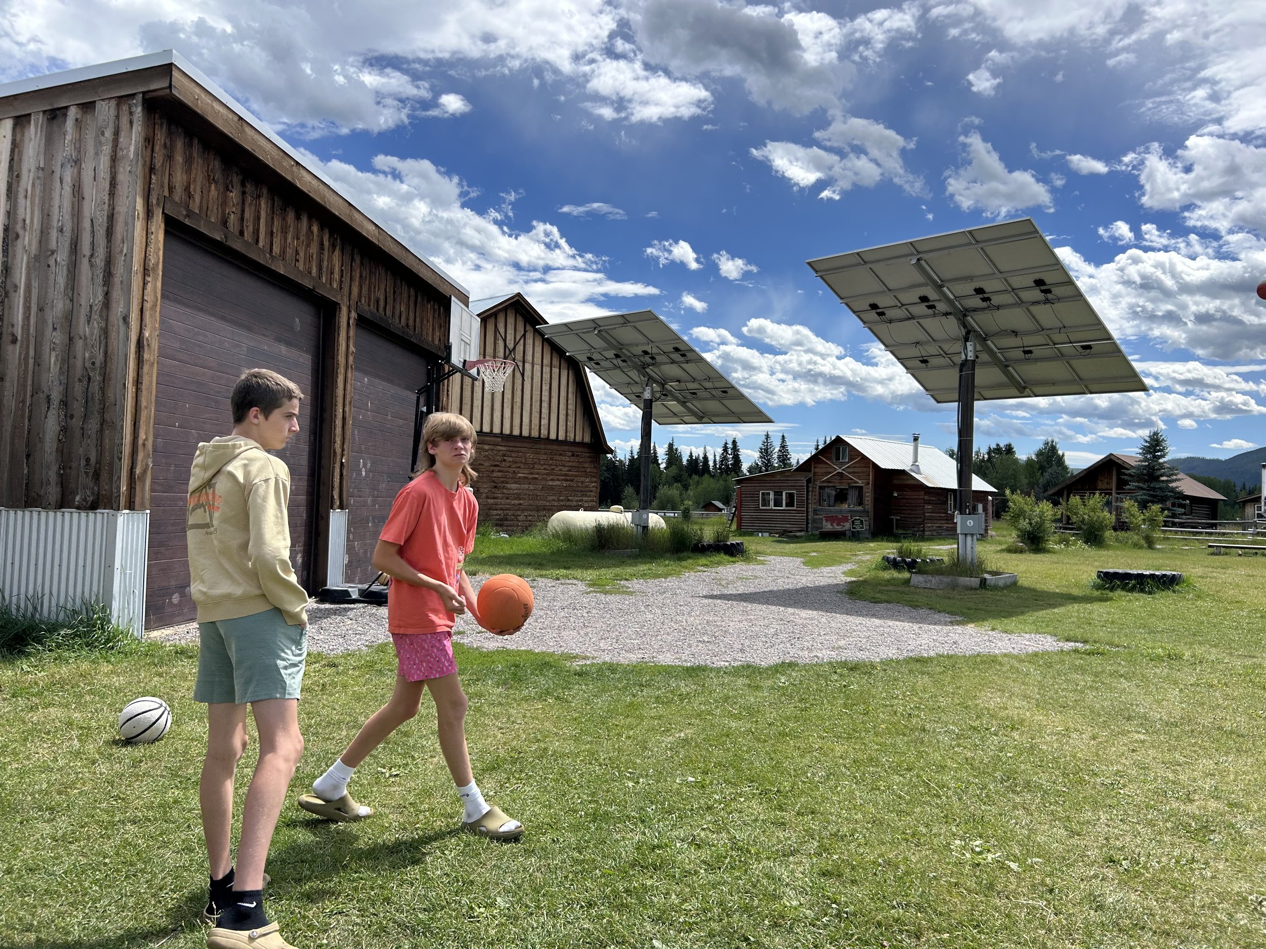
Day 2 was focused on North Fork, which was largely a gravel road snaking along the west edge of the park through the National Forest. We were told there was an interior road in the park in the past but that it has been washed out or damaged so many time they are sticking with the Forest Service to manage the exterior road further from the mountains and rivers. There is some world class fishing and rafting that draws people up this gravel road and it is very much “off the grid”. It’s all generators and solar for the cabins and small towns (like 10-20 people), one called Polebridge is a bit more tourist trap and served as a fun lunch stop. The views of the southern end of the North Fork road were the best and aside from Polebridge the trip north was more to say we did it than awe inspiring. It was a beautiful forest drive but if you’re not trying to cross into Canada we recommend stopping at Polebridge or making sure to rent a raft to float the river or do some fishing to make the trip up more than a dusty bouncy ride more exciting. Once back to the West Gate, we ended Day 2 with a second trip back up the Going to the Sun Road to go hiking at McDonald Falls, boulder jumping at Red Rock and to take in a sun set “in” Lake McDonald. Yes we got our feet/legs wet in the refreshing lake with red/green/bluish rocks bottom. The entire lake bed is colored rocks which is truly unique in a crystal clear lake and the sunset wasn’t bad either. Mountain sunsets are different since the color comes well after the sun drops behind the mountains but still got some unique pictures.
Glacier highlights are hard to differentiate but the lakes, the Going to the Sun Drive and the animals (grizzly, big horned sheep, mountain goats, Columbian ground squirrels, deer, a giant slug and tons of birds) were memories we tried to share and will remember for a long time.

North Fork entry.

The interior park road was damaged so we headed up on the outer National Forest road that follows the North Fork Flathead River north to Canada. It’s a passage gravel road but you’re truly off-the-grid with no cell services and very few ranches or homesteads to go to if you breakdown. 4 wheel drive recommended but not required, just need to be sure you have a spare.

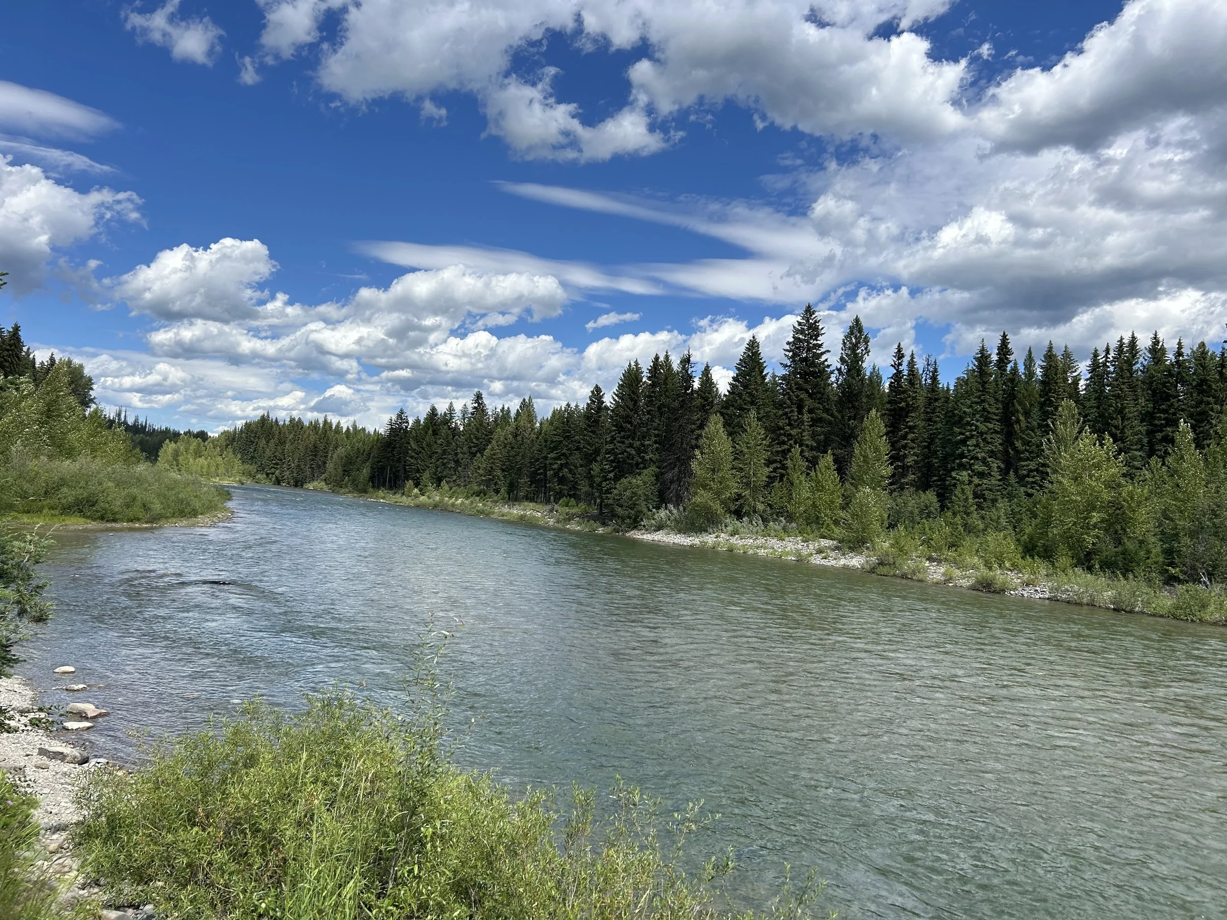
North Fork River was beautiful and we saw a number of rafters floating the norther branch. Would have been a good thing to try if we had some clue it was available. High recommend figuring out a float if you can.

This Isuzu didn’t make it and was gutted on the side of the gravel road like a cautionary carcass to adventurers north.
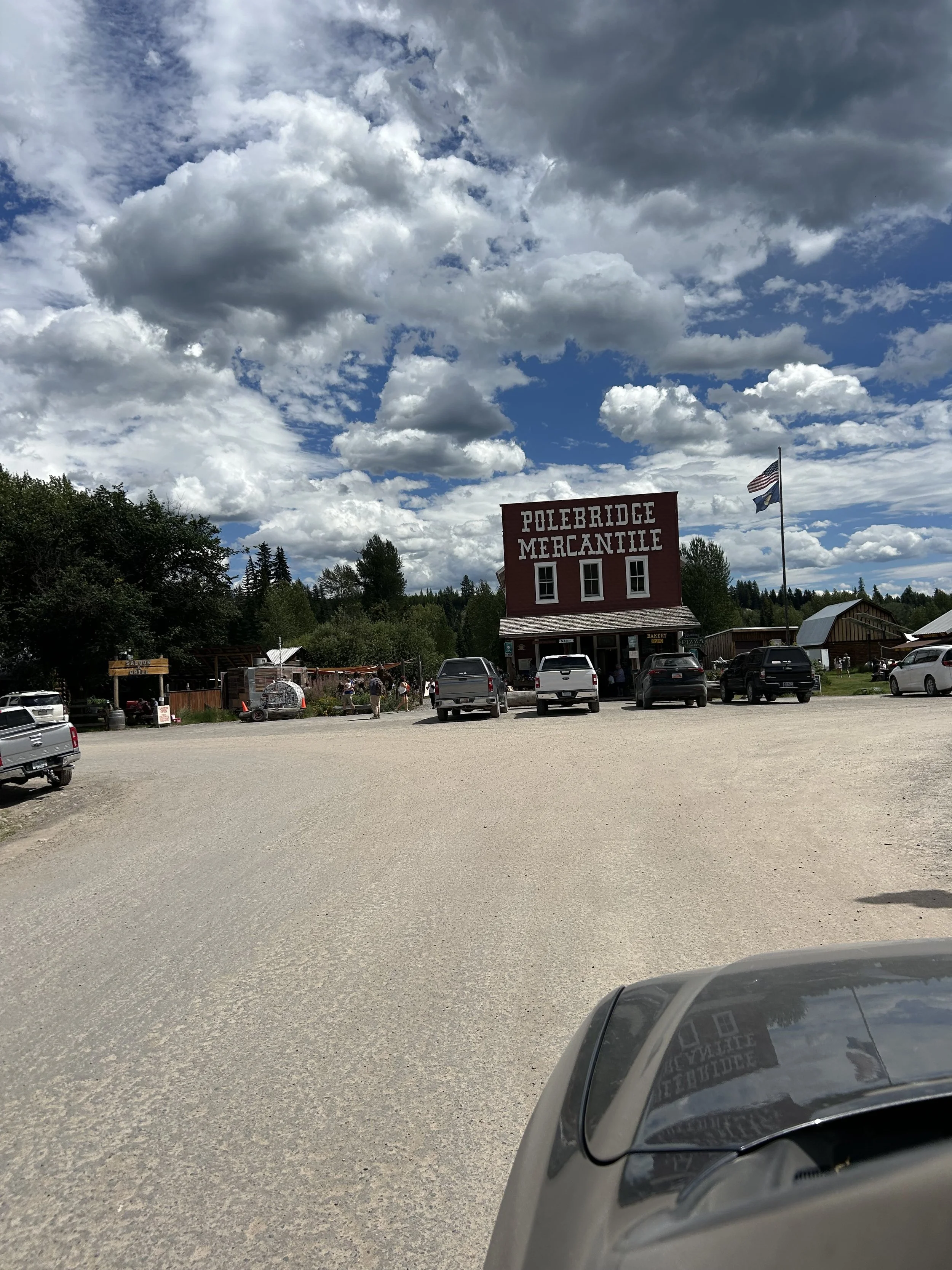
Polebridge is a small township about 30 miles form the Canadian boarder. It’s a total tourist stop but Montana mountain style. Fun and they have good food and a bakery as well as some fun for the kids.


This ranch was for sale… can you imagine having this as your porch view? Hope that day dream also includes generators and solar cause off the grid is beautiful but truly off grid!

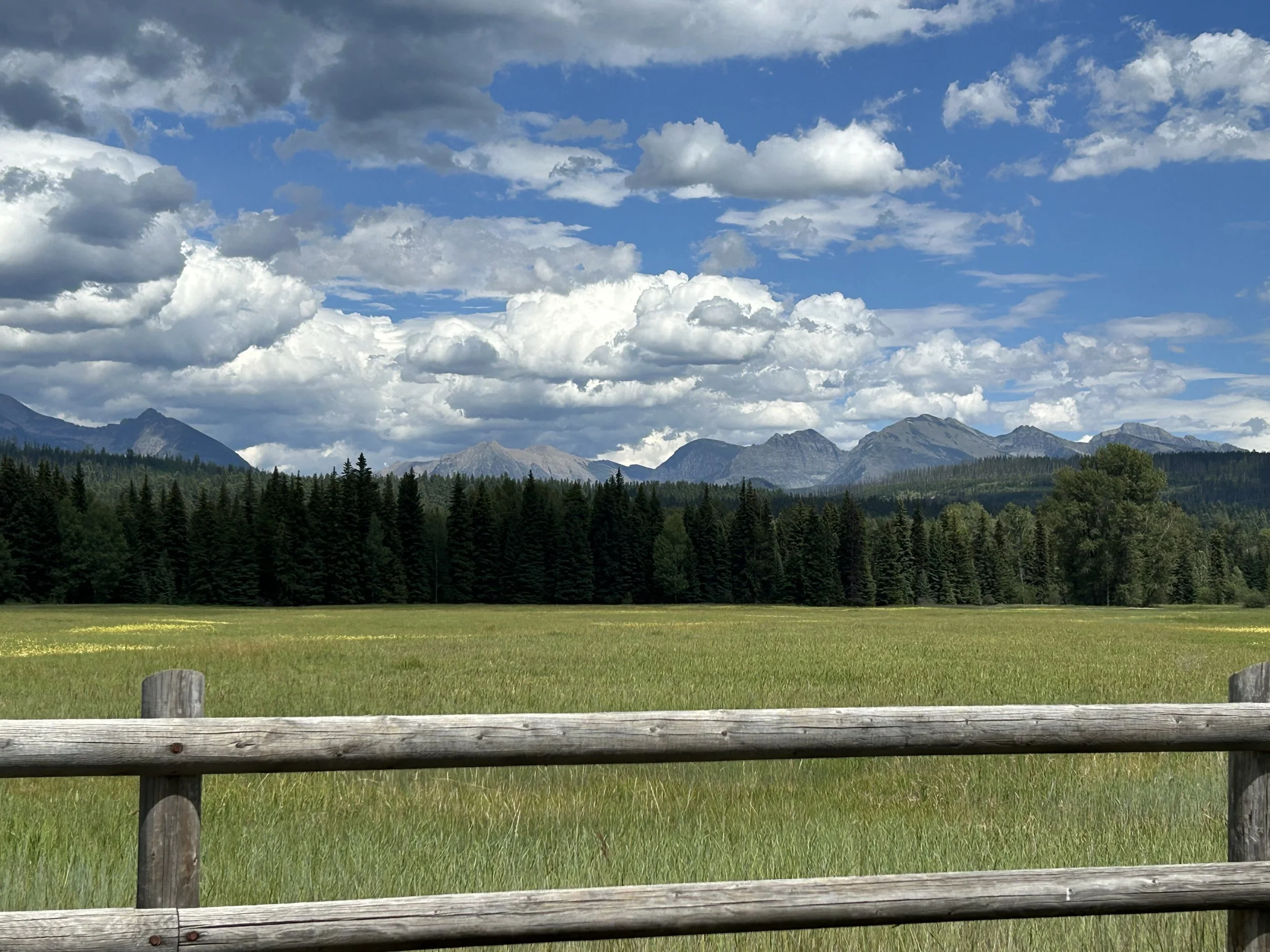
View of the Livingston Range in the Glacier National Park from North Fork Road.

Another view into Glacier from North Fork closer to Apgar.

Thought this was was a classic Montana mountain homestead.
View east of Lake McDonald and the mountain in Glacier from the North Fork gate. Some great biking out on the west side too, saw a number of bikers enjoying this view as they pushed up or coasted down the road.

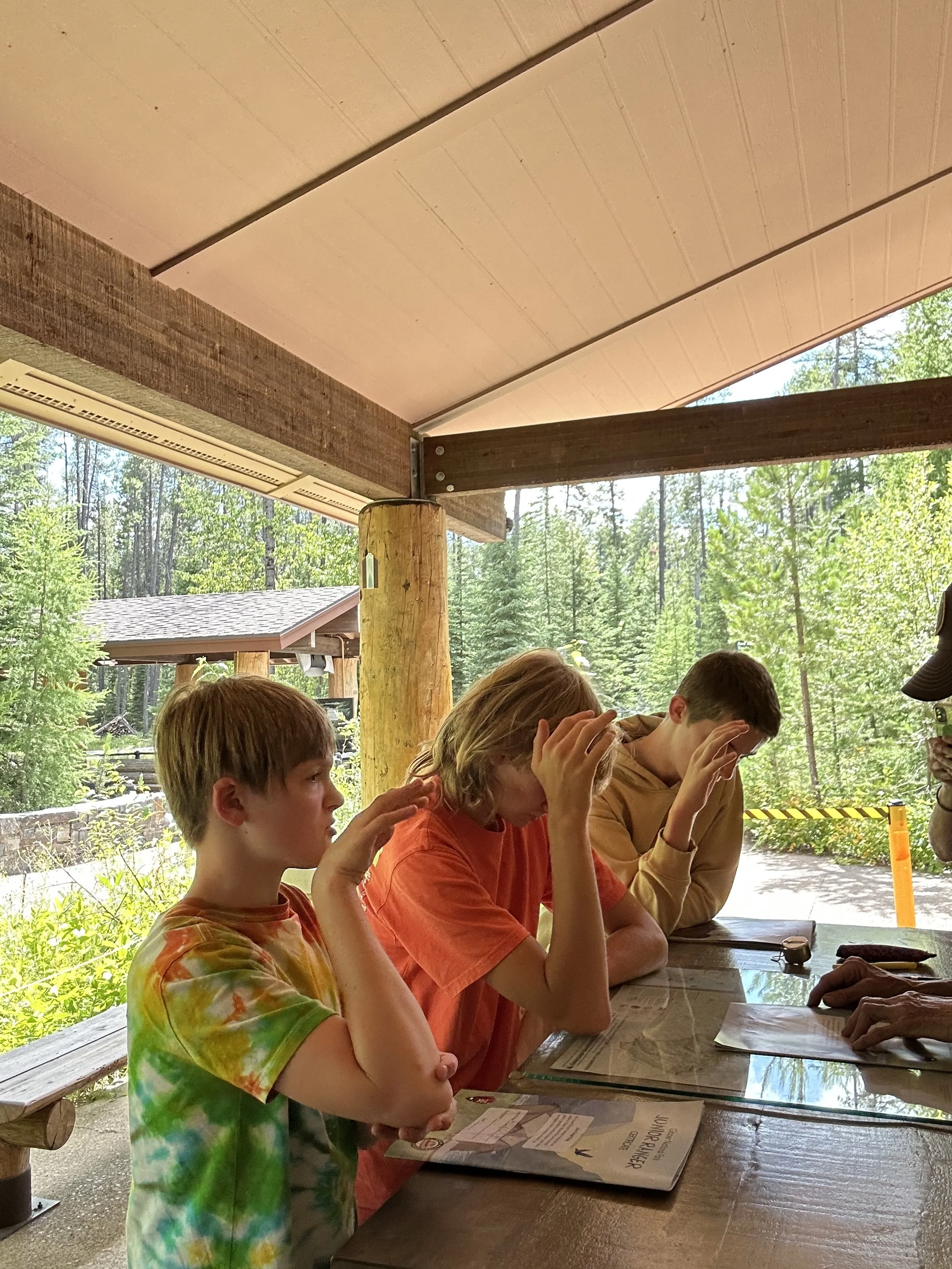
Completed our Jr. Ranger books at Apgar Visitor Center.

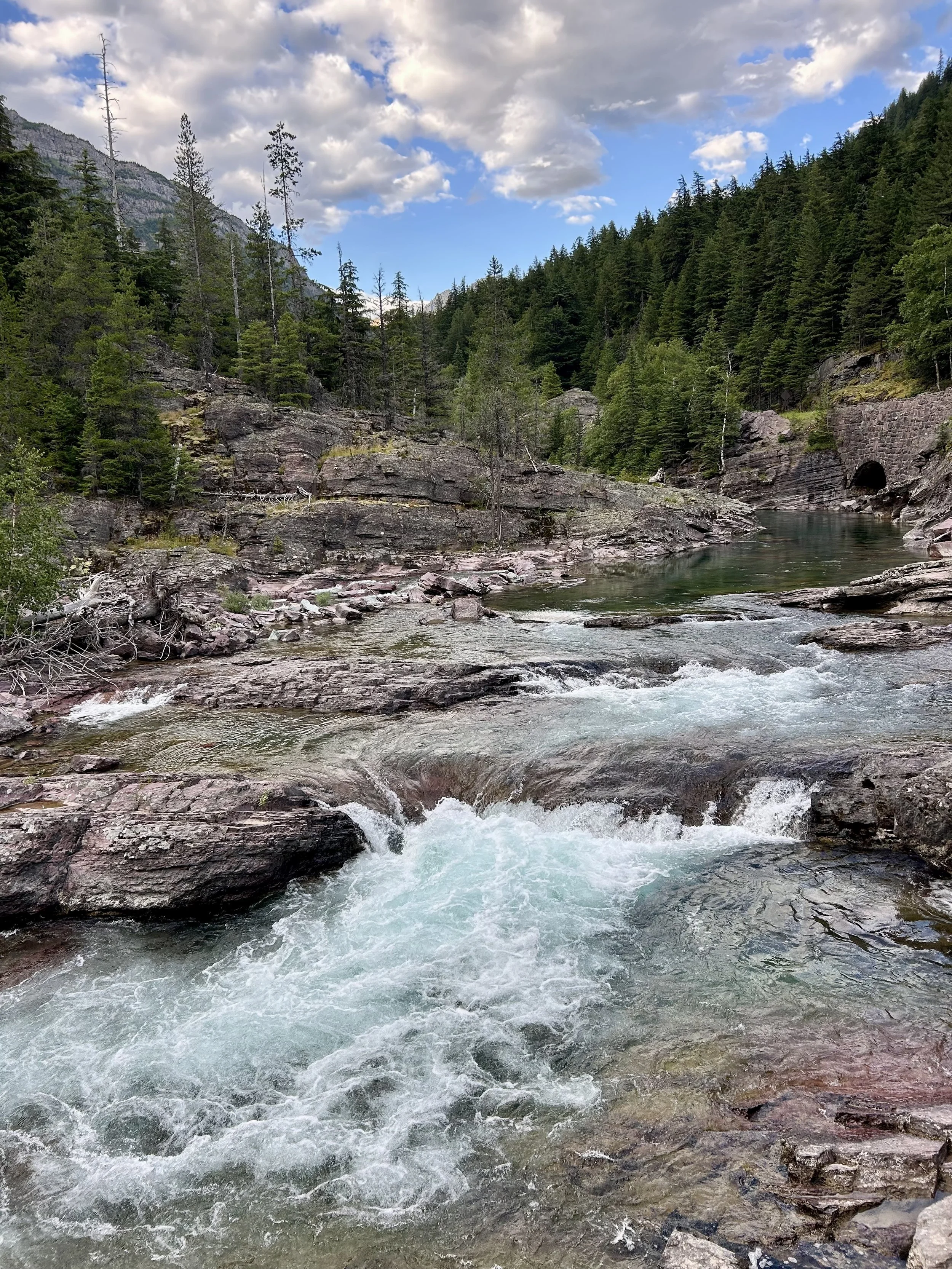
Highly recommend getting across the McDonald falls bridge to hike the combo horse trail and Upper McDonald Creek hiking trail. The west side of the creek is less traveled but has a great path along the creek with some amazing rock features carved out by the water. The geometric shapes of the rocks along the river are really intriguing. It’s like slate and the sedimentary rock comes up in sheets and in squares.

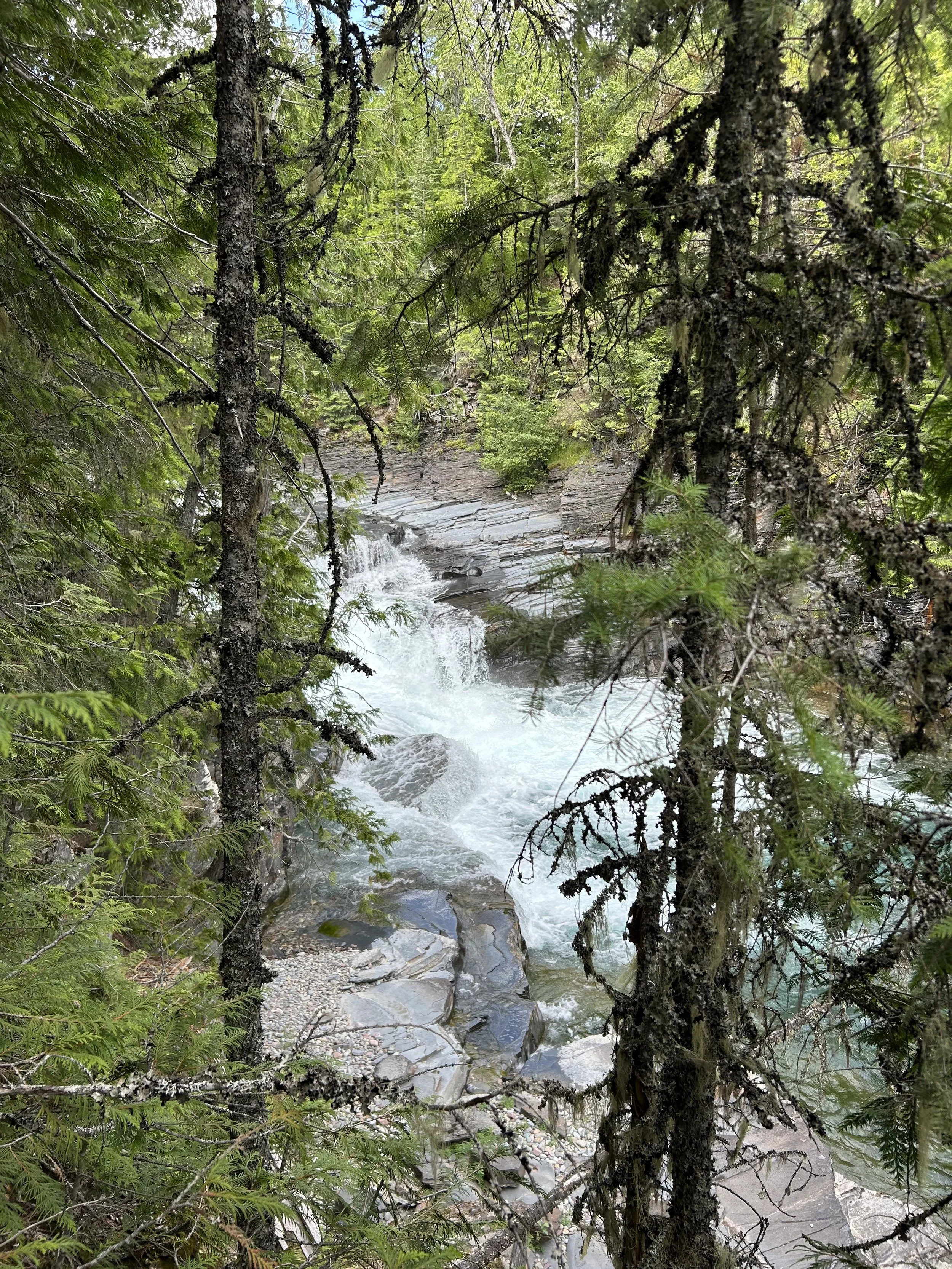
McDonald falls from the west side of creek.

The rock is shaped in stair steps along a ½ mile section above the falls.
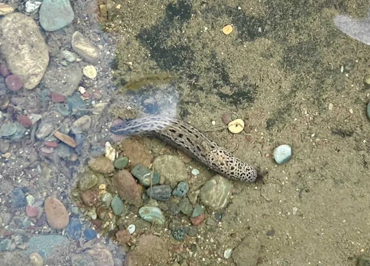
The water is super clear and the colored rock lines the river bed and you can even find a few Giant Garden Slugs if you look along the river shallows.
This is Red Rock, a marked spot on the Going to the Sun Road. The red is actually red jasper and quartz so it’s a stunning cascade and offers some fun too.

After the cascade there is a swimming hole with a boulder that invites some cliff jumping.

Jayden braved the 60 degree water and his first 15+ ft jump into water. He doesn’t like height so we’re proud of our cliff jumper!


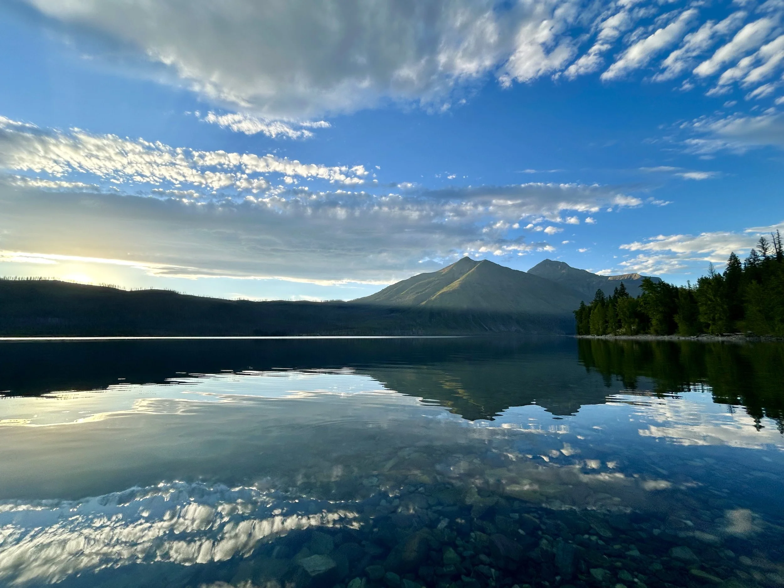
Lake McDonald for sunset. Beautiful reflection on the crystal clear water.
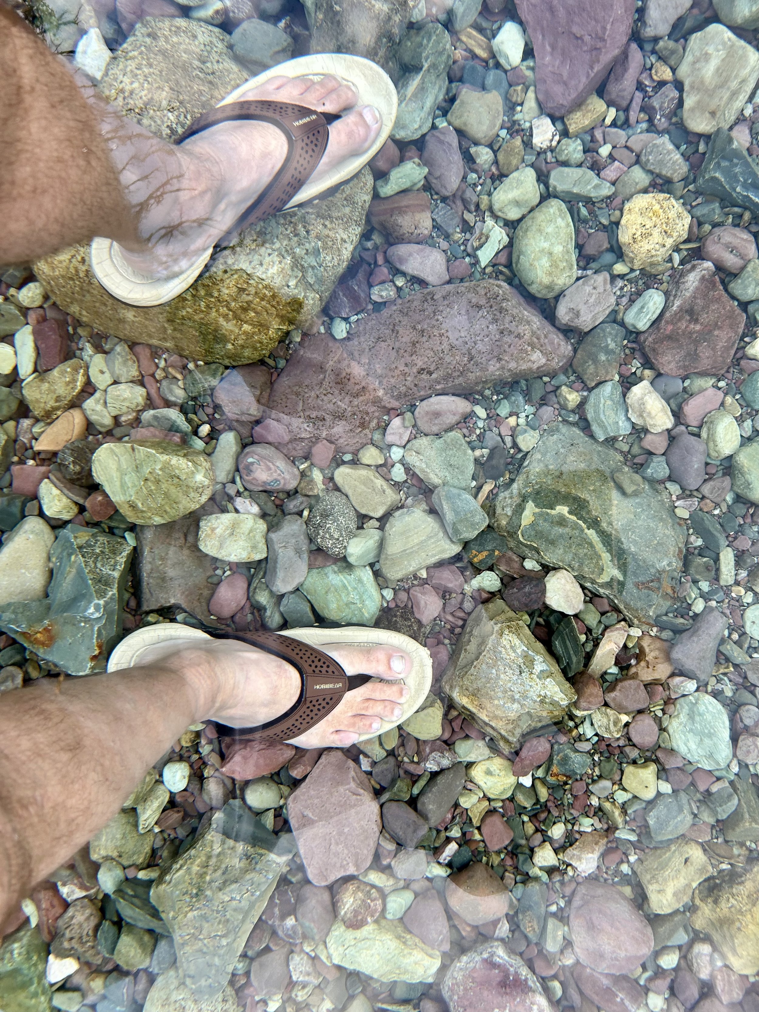
The rocks lining the Lake McDonald lake are super colorful and with the crystal clear water it’s a unique swim. If you can’t tell Vince is shin deep in the water for this picture.

The reflection of the sky disappears as the lake bottom becomes more visible.
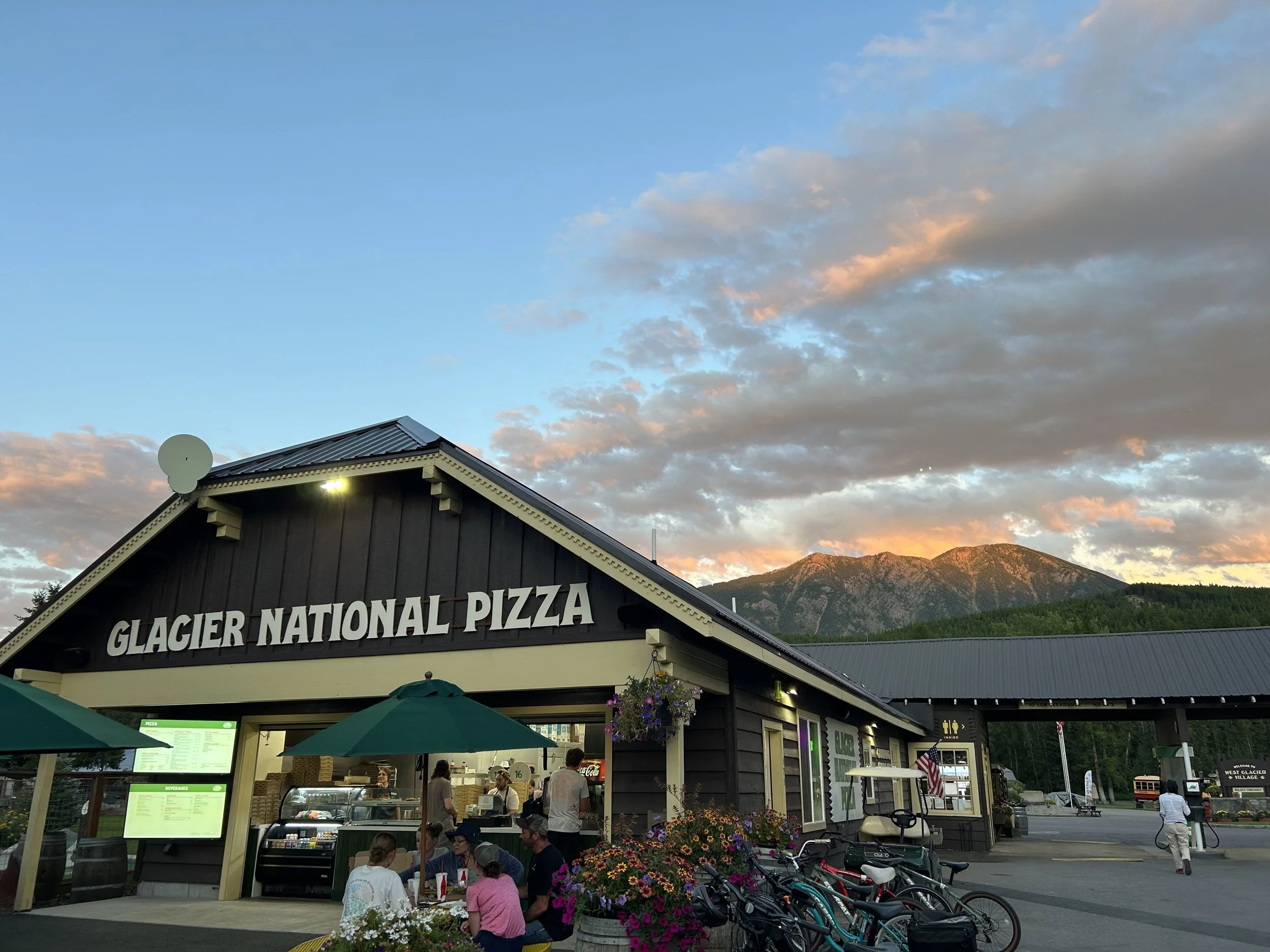
Finished the color part of the sunset, which comes about 30 minutes after the actual setting of the sun behind the mountains at the Glacier Village at Glacier National Pizza. It’s good pizza and the color on the mountain was an added treat.

The road out of Glacier was sad but beautiful drive as we head south to Deer Lodge and Yellowstone!